Sunday 2 November 2014

Independent learners in Geography

Since the start of term in September I have tried out some new ideas with my classes to help them become more independent learners.

Place of the week

I have randomly picked countries from around the world and created a long list. Each week a new country name is put on the whiteboard and students are now eager to find out where it is. Used as a starter activity at KS3, students find the location using an atlas and then write a geographical description in their exercise books. They are now much more able to use the atlas and know how to find a country, where to find its flag and how to use indicators such as GDP and birth rate. The more able students can use these indicators to explain the level of development in the country. Although there is not always time for this starter, the students are always keen to find out the new location for the new week.


Green pen time

Another starter activity that I have used with KS3 and KS4 students is "green pen time" - an idea built on a new school policy. The students use green pens to respond to my feedback in their exercise books (a mixture of questions, spelling changes, punctuation changes etc...) using reminders on the board. E.g. "sp" means spelling, "C" means capital letter, "P" means punctuation and "T" means a task to complete or a question to answer. Now the students have used this several times, they are much more independent and able to respond to the feedback without asking too many questions.


Takeaway homework menus

Using inspiration from many different takeaway homework menus on Twitter (http://bimblesgloopsandflobs.blogspot.co.uk/2014_01_01_archive.html?m=1#uds-search-results) I created a Nando's takeaway homework menu for my Year 8 classes who have been studying rainforests. It took a while to explain how to use the menu for the first homework task but the students are now more confident in choosing their own homework task and some have produced excellent work. It also allows for clear differentiation and the students feel slightly more enthusiastic about completing homework that they have chosen. Perhaps next term I can take it a step further and allow the students even more independence in creating their own homework tasks.


Sunday 4 May 2014

TES Geography Week


TES Geography Week, 28 April - 2 May 2014

The TES resources site is a valuable place to start research when creating new schemes of work. As I plan enquiry lessons I draw on ideas from lessons on the TES for my inspiration. There are also some fantastic enquiry lessons already available. Below are just a selection of what can be found.

Why can Grace now afford to go to school?
This is a brilliant 30 minute lesson which can be adapted for a longer lesson about sustainable tourism in Kenya. It allows students to examine the positives and negatives of tourism and the students could go beyond the lesson to consider if sustainable tourism is always successful.


Should we let Happisburgh disappear?
This is a lesson which allows students to consider the different coastal management options along the Holderness coastline. They will need some understanding of management before completing this lesson but it challenges their thinking and complicates their ideas of which areas should be protected.

How is my T-shirt made?

This lesson looks at the production chain of a t-shirt and considers who benefits from the production process the most. Beyond this lesson, students could debate whether this is fair or not and could think of their own solutions before exploring ideas such as Fairtrade.

How is Rafique affected by Mrs Wilson’s shopping trip?

This lesson is a mystery which allows students to explore interdependency and how our actions can affect the lives of others across the world. This is a well structured and interesting lesson which could be adapted into a scheme of work about globalisation.

Friday 18 April 2014

Geographical Association Conference 2014

This year I attended my 2nd GA conference. Last year, I walked away feeling inspired and buzzing with new ideas. This year was no different.

Below are my highlights of the conference and some ideas that are definitely worth sharing! By far the best were David Rogers and Margaret Roberts who both inspired me and encouraged me to move beyond the viewpoint of my job is too hard and I never have any time to create exciting things.

Lecture Plus 2 - The future of assessed fieldwork, R. Lucas
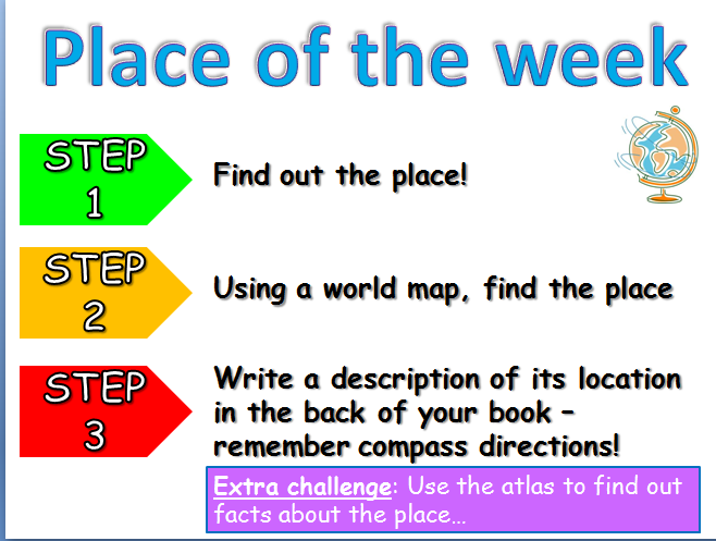
Fieldwork ideas

·         Use top trumps  to understand the local area – e.g. local Somerset villages – which is the most urban? Can also be used as a sampling strategy to choose locations.

·         Use a laminated grid of boxes to draw a field sketch to ensure that nothing is missed.

·         Verbal field sketches – in pairs facing each other. Person A describes the landscape behind them to Person B. Then peer assess description using a mark scheme, e.g. level 1 – describes simply, level 2 – application of geographical terms, level 3 – application of geographical language and recognises the bigger picture.

·         Geography parrot – only ever says one sentence ‘so what?’ Encourages students to move on to the next step from basic labels in field sketches. Processes – consequences – implications – future scenarios.

·         Breaking news – either in the classroom or on site. Create newspaper headline, e.g. ‘River meanders’. Then create the rest of the article: brief summary, details and facts, analysis and letters to the editor (to show different arguments using results from fieldwork).
Lecture 2 – The new National Curriculum, D. Rogers
The new National Curriculum should not be seen negatively but instead as a positive opportunity to restructure schemes of work. The curriculum also sets out to engage and fascinate students so that they remember Geography for the rest of their lives – surely a positive thing that we should all be aiming for?
One idea that I want to use in my KS3 schemes of work: Using creative writing to describe a volcano – imagine you were there. Read out a piece of creative writing to help students understand what a good and vivid description is. See the following blog link for further ideas... http://daviderogers.blogspot.co.uk/2013/09/describing-places-lesson-adapted-from.html
Workshop 30 - Mark my words, R. Kay
Marking is one of the current focuses at my current school and I will trial these ideas over the next term to see if it improves the time efficiency and effectiveness of my marking.
Use take-away menus to peer/self assess. Teacher marks books using the menu and writes down some numbers for the students to improve during DIT. The student writes down next to the number the task they need to undertake and then spends time improving their work. The numbers can also show progression as the higher numbers are more advanced. Assessment grids can also be placed in exercise books to show progression.
Purple pen marking  – when the students complete DIT they colour/shade their work using purple pencils so that it is clear that it has been completed.
 
Lecture 15 – Learning geography through enquiry, M. Roberts
This was the highlight of the conference for me. As a strong advocate of enquiry learning Margaret has some excellent ideas to get the students thinking instead of the teacher dictating.
Geographical evidence: using sources
5 key points – students find the key points from the data and then share information (e.g. a table of data)
Layers of inference – on an A3 sheet of paper a series of boxes. Source (e.g. map/photo); What does this source tell me? What can I infer? What doesn’t it tell me? What other questions do I need to ask?
The world according to... Students draw their own world map using their knowledge of the world.
Thinking geographically
Argumentation – claim, reasons, facts and backing, counter-arguments, does evidence need qualifying, conclusion of a claim. These can be used to investigate newspaper articles.
DART transformation  – reconstruct text as a diagram. First underline causes/effects/solutions (analysis of text) and then reconstruct pictorially. This forces students to read the text carefully.
Concept mapping  - making links between concepts.
Applying criteria – projects are assessed against assessment criteria. E.g. Peak District Sustainable Development Fund can be used to assess different National Parks.
Workshop 40 - Fieldwork beyond the textbook, N. Lapthorn
Built on the article, ‘Risky Fieldwork’ from Teaching Geography, Summer 2012. Should the students be carrying out more 'risky' fieldwork which might not achieve the perfect results? Should we as teachers be telling students what and how to investigate? Some really thought provoking ideas that made me reconsider how I teach fieldwork and how it could be improved...
How to introduce risk – allow students to decide own question/hypothesis/methodology
Data presentation – already risky to some extent but students should be given chances to create their own ideas of data presentation methods.
Questionnaires/surveys – provide students with a few categories and then they create the rest.
Ofsted requires improvement fieldwork – “formulaic and focused on meeting examination criteria”
 

Sunday 2 March 2014

Impossible Places

Ideas I came across while updating a Year 9 SOW about 'Impossible Places'...

1. Masdar City

A city in the United Arab Emirates which claims to be the first sustainable and carbon-neutral city. Useful way to start teaching renewable energy (as it relies heavily on solar power) or sustainability.

The videos and links below give an introduction to the city.

http://www.youtube.com/watch?v=8V7UpFOm8w0

http://news.bbc.co.uk/1/hi/world/middle_east/8586046.stm

http://www.theguardian.com/environment/2011/apr/26/masdar-city-desert-future

2. Neft Daslari

A settlement in Azerbaijan which is an offshore oil platform. It is actually a functional town with over 2000 residents. An interesting place in the world, could be used to teach about fossil fuels and the impact of using oil.

http://en.wikipedia.org/wiki/Neft_Da%C5%9Flar%C4%B1

http://www.spiegel.de/international/world/exploring-the-crumbling-soviet-oil-platform-city-of-neft-dashlari-a-867055.html

http://www.youtube.com/watch?v=N6lGa-Ow8XE

3. This website has some interesting ideas of places that are nearly impossible to get to:

http://www.buzzfeed.com/dray/8-places-that-are-nearly-impossible-to-get-to-and-4666

A range of landscapes and environments, the Yemeni town of Qalansiyah is remote and has some fantastically strange trees.


Sunday 19 January 2014

Why use GIS? Article worth reading in Teaching Geography!

Following on from my previous post about GIS I delivered a CPD session to members of my department. One of the most useful sources that I found was an article from Teaching Geography, which is definitely worth a read if you are unsure of whether to attempt using GIS:

Mitchell, L. (2010) Why use GIS? Teaching Geography 35 (1), p.18-20
 
If you are a GA member you may be able to access the journal online - http://www.geography.org.uk/Journals/Journals.asp?journalID=3

The following quote in particular was very useful in trying to convince my department that GIS was not a difficult thing to use or expensive...

“I had spoken to geography teachers who feared that using GIS could be too complicated, for themselves and for students. However, I found the opposite to be true.
Moreover, it was easy to incorporate GIS into existing schemes of works, it didn’t incur any additional costs and, importantly, it didn’t require too much extra planning and preparation.” (p.18)


Sunday 5 January 2014

What are Kew Gardens doing in Sumatra?

Putting GIS into tropical rainforests scheme of work

For a Year 9 SOW I was trying to think of different ways of using GIS (instead of just Google Earth or Scribble Maps) and came across a project by Kew Gardens in the rainforest of Sumatra.

http://www.kew.org/science-research-data/kew-in-depth/gis/vegetation-mapping/harapan/vegetation-maps/index.htm

This is a great example of how GIS is actually used by scientists and links to a news story about how Google Earth have also been mapping the rainforest. This way students can learn about the importance of GIS whilst also practising their own IT skills.

I created a worksheet for students to follow researching what Kew Gardens are trying to do in Sumatra whilst also plotting their findings on Scribble Maps. Through a series of tasks students focus on the conservation of tropical rainforests and the higher ability students are challenged to consider the benefits and problems of using GIS.